 |
| A - Adelaide, B - Arkaroola, C - Flinders Park |
The 5-day trip to the Flinders Ranges definitely was an adrenaline-pumping adventure! So different from the terrain and character of anything else I've seen, the Flinders Ranges and Arkaroola has an amazing landscape that could be summarized in only one word -
wild; and so was our experience traveling through the outback!
We met some terrific people - the Aboriginals, adventure-seeking Adelaidians, people with so much passion for this arid place that they dedicate dozens of years to it. I've realized that for many, Flinders becomes a part or a final destination of a spiritual soul-searching pilgrimage. For us, casual adventure-seekers with kids, soul-searching is out of the question and Flinders came to represent the outback of South Australia.
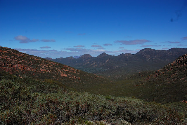
The Flinders Ranges is the largest mountain range in South Australia, which starts approximately 200 km north west of Adelaide. The discontinuous ranges stretch for over 430 km, with the highest point, St. Mary's peak at 1170m. The northern ranges host the Arkaroola wilderness sanctuary and the southern rim is mostly known for Mt. Remarkable.
 |
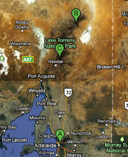
| The Ochre wall |
Arkaroola Wilderness Sanctuary is a 64,000 hectares property,
privately-owned and operated by the Reg Sprigg (a former government geologist) family. It is recognized as a premier eco-tourism destination.
We arrived unexpectedly late having battled through few flooded creeks in a rental car. When the Little Nomads were in bed, we sat outside enjoying some Barossa wine with newly-made acquaintances from Adelaide. The next day we found out that the roads (or tracks) of the hills had been washed out by week-long torrential rains that had poured days prior to our arrival; our main attraction, the Ridge Top tour, was canceled. We packed kids' backpack with light snacks and water and explored the hills via 6km Acacia Ridge trail.
The next day we took a 5-hour 4WD tour across the bush and mountains. Our guide was not only a skillful driver, but also an eloquent story-teller, a professional geologist, and a well-traveled person who spent over 10 years in Arkaroola for its unique character. He told us about the Aboriginals, showed us native plants and stones, the history, geology, flora and fauna of the place. We went up to the highest point of the park and had coffee and cake. Enlightened, we got a ride to our car and headed to Flinders Ranges National park for the next leg of our trip.
 |
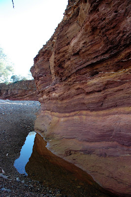
| Acacia Ridge Trail |
 |
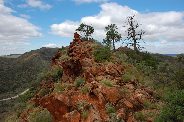
| A view from Mt Jervis |
We spent the next 3 days in the remarkable
Flinders Ranges National Park bushwalking, took scenic drives around the area to see gorges and hills, climbed ridge tops to view spectacular views of the red mountains and green valleys, visited abandoned ruins of the settlers' homesteads, hiked to see Aborignal cave art, saw innumerable flocks of emu, kangaroos, wallabies, foxes, etc.
But if there was one thing I had wanted to see in Flinders, it was the postcard view of southern rim of the Ranges that encircle Wilpena Pound (the pound is a beautiful natural basin surrounded by steep walls of mountain and is commonly mistaken for a volcano crater. In fact, it is an eroded mountain top). And I did - by foot, by car, and from the air! The latter would be my most memorable experience of the trip!
 |
| A flock of emus |
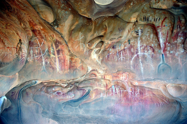 |
| Aboriginal art at Arkaroo rock |
 |
| Wilpena Pound and southern rim of the Ranges from the air |
 |
| The Flinders Ranges |


No comments:
Post a Comment